One more week and I’ll be home–back in San Francisco.
Saturday, 24 July 2010
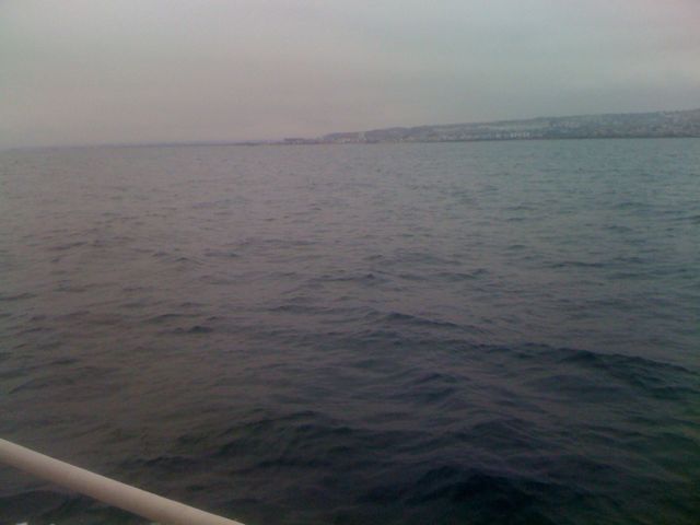
Last Saturday, I left San Diego, rounded Point Loma and sailed up to Mission Bay. There is a beautiful inner harbor for transient boats that has a flat, sandy bottom and well-protected and calm. You can see the Sea World tower from inside–and, watch the fireworks. I anchored in there for the night, and left in the middle of the night to reach Dana Point the next morning.
Sunday, 25 July 2010
The sail to Dana Point was nice and easy, but when I arrived, I was exhausted. I think the 6 weeks at sea is finally taking its toll. Inside Dana Point is another protected anchorage, and I dropped the hook in 25 feet of water–in what has to be the calmest place I have ever been. It was even more peaceful than being tied up to a dock. The downside is that someone has to stay aboard at all times, and being a single-hander, that someone was me. I quickly fell asleep and slept through the night until the next morning.
Monday, 25 July 2010
After a nice breakfast, I pulled the anchor and sailed on a lovely broad-reach the short trip to Catalina. My first inclination was to skip Avalon, and sail up to Goat Harbor and drop the hook. So, I continued onwards and up Catalina. Around 5pm, as I was approaching Goat Harbor, the wind shifted so that it was out of the lee of the island, and I got blasted by 25 knots of wind. I put in a reef in the main, but with the auto-pilot faltering, it still couldn’t hold a course with any sail up at all. Despite all of the sleep from the previous night, I was still exhausted, so I turned around (and sailed WITH the wind for the first time in 1100 miles), and ended up back at Avalon.
In Avalon, I contacted the Harbor Master’s office, and rented a mooring ball for the night. They were out of space in the inner harbor, but had room in the outer harbor. They have the boats packed so tightly together that you moor both the bow and the stern! As soon as the boat was on the mooring ball, I was out. It was very rolly on the outside, but I was exhausted, and slept easily.
Tuesday, 26 July 2010
I awoke kinda late, but was excited to see the mythical city of Avalon. 😉 So, I inflated the dinghy. It was too rolly to put the motor on, so I grabbed the oars and rowed into town looking for a shower and some food. And, WOW–what a town. Nestled on that beautiful island is an incredible town. Found the showers, drank some beers and ate dinner, took some awesome pictures, and at the end of the day, went to the movies. Some time ago, they converted the Casino to a movie theatre, so I watch the one movie that was playing–Inception. Popcorn, soda and the movies. I loved it.
A brisk row back to the boat and I was sacked out.
Wednesday, 27 July 2010
In Catalina, you have to be off the mooring ball by 9am. So, around 0845, I was motoring out to sea, and heading up the coast. The weather was supposed to be pretty typical–10 – 15 knot winds during the day building to 15 – 20 knot winds. I sailed past Two Harbors and all the way to the North-Western tip of the island, and set the hook in a small bight and slept.
Thursday, 28 July 2010
Around 9pm, I weighed anchor and headed off to sea. I made great time and an easy, overnight passage up to the Northern Channel Islands. By sunrise, I had passed Anacapa Island and reached the Eastern edge of Santa Cruz Island. And, what an island! I cannot wait to return and take a few days to explore this island. There are tall cliffs that rise out of the deep water, birds circling in the air, and dozens of picturesque bights where you can tuck your boat away for some rest. It was impressive.
I continued around the North side of the island to see Painted Cave–a 1200-foot ocean cave (supposed to be the largest in the world), and continued to enjoy the lovely conditions. By 8:30am, the wind had picked up dramatically–despite the forecast predicting it would happen around 1pm. Once the winds freshened to a steady 30 knots, the auto-pilot could no longer hold the sail.
There was another little problem . . . . On Marishanna, we have the SSB radio using the center section of the backstay as an antennae. You put an isolator on the backstay at the top, and at the bottom of the section to be used, and then run the antennae cable up to the section and attach it with a hose clamp. Well . . . the tape wrapped around the clamp has come loose, and the runners caught it–and, they like to catch it, rather than merely whisking off of it. I can clear it with a boat hook, but until I can get the tape re-wrapped, it is something else that requires attention.
So, faced with a failing auto-pilot, +30 knot winds, and runner complications, I decided to drop the mainsail and lash it to the boom. According to the map, I had to round the far Western point and cross the channel to get to the North Eastern anchorage on Santa Rosa Island. I proceeded around the final point and started into the channel and the waves built to 2-meter waves with a frequency of about 3 seconds. Without the sail up, Marishanna and I were getting hammered.
About 15 minutes into the final stretch (about 8 miles left–I could see the anchorage), the engine sputtered and coughed and died. To summarize: no mainsail, failing/failed autopilot (not able to keep the nose into the wind for me to get the sails back up), engine died, being blown into a lee shore, winds gusting to 35 knots, and 6-foot waves every 3 seconds.
Unable to leave the helm, I started the motor again, and with a little logic, determined that as the engine started to sputter and die, I could press the Preheat button and it would fill the cylinders with diesel and the engine would continue to run. I knew there was fuel in the tanks–and, hoped that this temporary solution would work to get me out of the lee shore, and immediate danger–which it did.
There was a protected anchorage close (just behind the visible rocks), but I had not reviewed that anchorage any more than a cursory review–and, I thought I remembered some underwater rocks (which was probably why I did not select it in the first place). Unable to leave the helm and review the charts, I chose to try to run across the channel the final 8 miles to the original anchorage. I had already reviewed the charts and knew that it was an easy entrance, no underwater obstructions, protected, and 4 – 6 fathom sand-bottom. If at some point, the engine died altogether, I would be in the center of the channel and could run with the wind and have 30 – 40 miles of clear seaway–plenty of time to improvise, repair, set out a drogue, etc.
Thankfully, my luck held, and I was able to manipulate the iron jenny to get me all the way to the anchorage. Once there, I set the hook, and was for some reason, exhausted. 😉
Friday, 29 July 2010
After the previous days events, I scrapped the plans for the 40-mile run to Cojo Anchorage just below Point Conception, and instead, diverted to Santa Barbara for repairs. I picked up the weather information, had weighed anchor by 0545 and made an easy run, sputtering motor and all to Santa Barbara on flat, calm seas, running with 3 – 8 knots of wind. It was an easy anchor–the Santa Barbara anchorage is spacious and although windy in the afternoons, quite nice.
From my estimation, the motor problems are a fuel-related. I am going to start by changing the fuel filters–am on the hunt for new filters now. If that doesn’t resolve the problem, I will have to unseal the fuel tank and visibly inspect if something is clogging the pickup tube. If it is clean, then it has to be a problem with the lifting pump. There could be a pinhole in the lifting pump diaphragm–just large enough to weaken it from pulling fuel from the bottom of the tank (there is less gravity helping the process at the bottom of the tank than when the tank is full).
As for the backstay/runner binding issue: I have figured out that with a pair of prusik knots, I can ascend a line and get up to that clamp to get it cleaned, and re-wrapped with tape–and, no longer an issue.
As for the autopilot: There is no hope–the unit simply needs to be replaced. I’ll do a cursory search for one here in Santa Barbara, but it is most-likely a to-be-ordered part, and very expensive. Without a working autopilot, there is no way for me to sail the boat. Just to tack the boat, I would need to tack the jib sheet, tack the main sheet, change the working runner from one side to the other, AND man the helm. I simply cannot do four things simultaneously. For the last few legs, I’ll have to motor-sail Marishanna.
Exhausted and ready to be home, I’ll keep you posted . . . .